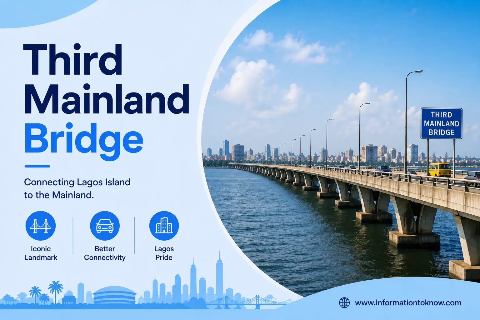
If you live in, work in, or plan to visit Lagos, sooner or later you will have to deal with the Third Mainland Bridge. It is the 11.8-kilometre road bridge that carries millions of Lagosians across the lagoon between the mainland and Lagos Island every week — and knowing its history, its rules, and how to cross it without losing hours to traffic can genuinely change your day. This guide pulls everything into one place: the facts, the story behind it, its ongoing repairs, the alternative routes, and the safety tips that matter.
Jump To
What Is the Third Mainland Bridge? (Quick Facts)
The Third Mainland Bridge is the longest of the three bridges linking Lagos Island to the Lagos mainland, stretching about 11.8 kilometres across the Lagos Lagoon. Built by Julius Berger and opened in 1990, it is the busiest crossing in Nigeria’s commercial capital and remains toll-free.
Here are the essential facts at a glance.
NB: Slide left to view the table if you’re on mobile.
| Feature | Detail |
|---|---|
| Length | 11.8 km (about 7.3 miles) |
| Official name | Ibrahim Babangida Bridge |
| Location | Lagos, Nigeria — across the Lagos Lagoon |
| Connects | Lagos mainland (Oworonshoki/Iyana-Oworo) ↔ Lagos Island (Adeniji Adele) |
| Built by | Julius Berger Nigeria Plc (with partner contractors) |
| Opened | 1990 (commissioned by President Ibrahim Babangida) |
| Ranking | Longest bridge in Nigeria (and one of the longest in West Africa) |
| Lanes | Eight lanes (dual carriageway) |
| Toll | None |
| Speed limit | 80 km/h (enforced by speed cameras) |
| Not allowed | Pedestrians, cyclists, and large trucks |
History of the Third Mainland Bridge
The bridge exists because 1970s and 1980s Lagos was choking on its own traffic. As Lagos grew into Africa’s most populous city, the two older crossings — the Eko and Carter bridges — could no longer cope, and even alternate-day driving schemes did little to ease the gridlock, so authorities planned a third bridge to relieve congestion and improve access from the city’s port, according to the Institution of Civil Engineers.
It was built in two phases. The Institution of Civil Engineers records that phase one, between Lagos Island and the interchange at Ebute Metta, was constructed from 1976 to 1980, while phase two extended the bridge north to Oworonshoki between 1988 and 1990. It was commissioned in 1990 during the military era, and its official name — the Ibrahim Babangida Bridge — comes from the Head of State who opened it, though almost everyone simply calls it the Third Mainland Bridge.
How Long Is It and Where Does It Run?
The Third Mainland Bridge runs about 11.8 kilometres from the mainland to the island — roughly a 15-minute drive end to end when traffic is light. It begins around Oworonshoki/Iyana-Oworo on the mainland and ends at Adeniji Adele on Lagos Island, providing access along the way to key areas such as Ebute Metta, Yaba, and Iyana Oworo.
One common myth is worth correcting: the bridge is often called “the longest in Africa,” but that has not been true for decades. It held that title only until 1996, when Cairo’s 20.5-kilometre 6th October Bridge overtook it, as official records confirm. Today, it is accurately described as the longest bridge in Nigeria and one of the longest in West Africa.
Engineering and Design: What Makes It a Landmark
Beyond its length, the Third Mainland Bridge is a genuine feat of engineering built to stand in open lagoon water. It is made from pre-stressed reinforced concrete, and official records show its foundation piles were driven to depths of between 36 and 54 metres, with 1,500 mm-diameter piles used for the main crossing over the lagoon.
That scale is also why the crossing is so scenic. From the eight-lane deck, drivers get sweeping views of the Lagos Lagoon, the University of Lagos waterfront, and the stilt community of Makoko — one reason the bridge features so often in Nigerian films, music videos, and photography.
The same design also explains why the bridge is in near-constant maintenance. Its most vulnerable points are the expansion joints that let the deck flex and the supports sitting in the lagoon, so rehabilitation work concentrates there. The 2025 Lagos advisory described the closures as necessary for work on the bridge’s expansion joints, while the 2024 federal repairs centred on under-deck and underwater sections. In other words, the periodic closures are the price of keeping a 1980s-era lagoon crossing safe under 21st-century traffic loads.
Why the Third Mainland Bridge Matters to Lagos
The bridge is far more than a road; it is an economic artery for Nigeria’s busiest city. Lagos is the country’s most populous and most commercial state, and the Third Mainland Bridge is the most direct link between the residential mainland and the business districts of Lagos Island and Victoria Island.
Every working day, hundreds of thousands of commuters, traders, and goods move across it. Without the bridge, journeys that take under an hour would stretch into far longer detours through the older, smaller bridges — which is exactly what happens whenever a section closes for repairs.
Traffic on the Bridge and How to Avoid It
Expect heavy traffic during rush hours, and plan your crossing around them. Congestion is typically worst island-bound in the morning — many commuters describe crawling traffic from roughly 7am to 9 or 10am — and mainland-bound in the evening as workers head home.
To keep your commute sane:
- Travel off-peak. Mid-morning and early afternoon crossings are usually far smoother than the 7–10am and evening peaks.
- Consider the water or a bus. Lagos ferry services and BRT buses can bypass the worst of the road congestion.
- Use ride-hailing or a driver if you would rather not fight the bridge yourself, and leave a buffer for delays.
Repairs, Closures, and the Bridge’s Condition
Because it carries so much weight every day, the Third Mainland Bridge needs regular rehabilitation — so periodic, phased closures are a normal part of its life, not a one-off crisis. Works typically target the expansion joints, pavement, and the underwater supports, and they are usually done in stages so that at least part of the bridge stays open.
Recent years show the pattern clearly. In early 2024, the Federal Government partially closed the Iyana Oworonshoki–Adeniji Adele section of the bridge for comprehensive rehabilitation, announcing alternative routes for motorists as the works began. After about three months of partial closure, the bridge was reopened in April 2024. Later that year, the government closed the bridge to large trucks amid critical structural repairs. Minister of Works David Umahi said decades of neglect had left the bridge dangerously deteriorated and warned that further delays to the underwater works could push reconstruction costs as high as N6 trillion. In 2025, Lagos announced a 110-day traffic diversion for emergency repairs on the Oworonshoki/Third Axial Bridge that feeds the Third Mainland Bridge, carried out in eight phases across both lanes.
The practical takeaway is simple: closures come and go, so always check the latest Lagos State or Federal Ministry of Works travel advisory before you set out, rather than assuming the bridge is fully open on any given day.
Alternative Routes When the Bridge Is Closed
When part of the Third Mainland Bridge shuts, the older bridges become your friends — and the government usually publishes official diversions. During the 2024 closure, the authorities advised motorists coming from Iyana Oworo, Toll Gate, Ogudu or Ibadan to reroute through Gbagada and Anthony onto Ikorodu Road/Western Avenue, then Funsho Williams Avenue to the Carter Bridge or Eko Bridge, while island-to-mainland traffic was directed onto the Eko or Carter Bridge.
For the 2025 Oworonshoki repairs, Lagos published a similar set of diversions in its travel advisory, including:
- Lagos-Ibadan Expressway commuters: Ojota Slip Road → Ikorodu Road → Anthony, then on to Oshodi.
- From Ikeja: Maryland → Funsho Williams Avenue → Outer Marina.
- From Victoria Island toward Ketu/Ikorodu: Eko Bridge → Funsho Williams Avenue → Ikorodu Road.
Exact diversions change with each phase of work, so treat these as your fallback corridors and confirm the current advisory before travelling.
Safety on the Third Mainland Bridge
The bridge is generally safe when you keep moving, but two rules matter. First, respect the 80 km/h speed limit — after the 2024 reopening, the Federal Government set an 80 km/h limit and backed it with speed cameras, and speeding attracts fines. Second, do not stop or park on the bridge unless it is a genuine emergency. Nigerian press has reported cases of thugs targeting stranded or parked motorists on the bridge, particularly late at night, so if your vehicle can move, keep going until you are safely off it.
For the same safety reasons, pedestrians, cyclists and large trucks are restricted — the Third Mainland Bridge is designed for private and passenger vehicles.
Is the bridge really “shaking”?
Every so often, viral WhatsApp and Facebook messages claim the Third Mainland Bridge is shaking or that a section has “opened up” — and they spread fast because so many people depend on it. Treat these with caution. In January 2025, fact-checkers rated the “shaking” claim false after the Federal Controller of Works in Lagos, Olukorede Kesha, drove the full length of the bridge with journalists and reported no signs of instability, describing the claim as baseless and recurring. The bridge does need genuine maintenance, but a wobble panic on social media is not the same thing as an engineering verdict. Rely on official Federal Ministry of Works or Lagos State channels before believing a forwarded message.
The Third Mainland Bridge vs. Eko, Carter, and the Fourth Mainland Bridge
The Third Mainland Bridge is the longest and busiest of the three bridges connecting Lagos Island to the mainland, but it is not alone. Each has its own role, which is why the older two anchor most alternative routes during closures.
NB: Slide left to view the table if you’re on mobile.
| Bridge | Opened | Notes |
|---|---|---|
| Carter Bridge | 1901 | The oldest crossing, built in the colonial era, runs from Iddo on the mainland to Idumota on Lagos Island. |
| Eko Bridge | 1975 | The shortest of the three, it was Julius Berger’s first major project in Nigeria, running from Ijora to Apongbon. |
| Third Mainland Bridge | 1990 | The longest (11.8 km) and busiest, connecting Oworonshoki to Adeniji Adele. |
Relief may also be on the way — eventually. The planned Fourth Mainland Bridge is a roughly 38-kilometre project intended to link the Lekki/Ajah corridor to Ikorodu across the lagoon and take pressure off the existing three bridges. Lagos has said it would be delivered as a tolled public-private partnership with a design speed of 120 km/h, and that, once built, it would rank as the second-longest bridge in Africa, with three toll plazas, nine interchanges and a 4.5-kilometre lagoon span. Progress has been slow, though: the state’s deputy governor said in late 2024 that soaring inflation had roughly tripled the project’s original ~$2.5 billion budget, sending the government back to the negotiating table, with completion targeted around 2027. Until it arrives, the Third Mainland Bridge remains the backbone of cross-lagoon movement in Lagos.
Plan Your Crossing With Confidence
Now that you know the Third Mainland Bridge inside out — its history, its rules, and its recurring repairs — the smartest thing you can do before any crossing is to check the latest Lagos State or Federal Ministry of Works travel advisory, so a surprise closure never catches you out. Beyond that, keep it simple: avoid the 7–10am and evening peaks, keep your speed under 80 km/h, and never stop on the bridge if you can help it. Do those three things and this iconic Lagos landmark becomes what it was built to be — the fastest way across the lagoon.
Frequently Asked Questions on Third Mainland Bridge
How long is the Third Mainland Bridge?
It is about 11.8 kilometres (roughly 7.3 miles) long, making it the longest bridge in Nigeria and one of the longest in West Africa.
Who built the Third Mainland Bridge?
It was built by the German firm Julius Berger Nigeria Plc, together with partner contractors, in two phases.
When was the Third Mainland Bridge built and opened?
Construction ran in two phases — 1976–1980 and 1988–1990 — and the bridge was commissioned in 1990.
Why is it called the Third Mainland Bridge?
It is the third bridge built to connect Lagos Island to the mainland, after the Carter Bridge and the Eko Bridge. Its official name is the Ibrahim Babangida Bridge.
Is the Third Mainland Bridge the longest in Africa?
It was the longest in Africa until 1996, when Cairo’s 20.5 km 6th October Bridge overtook it. Today it is the longest bridge in Nigeria and one of the longest in West Africa.
What does the Third Mainland Bridge connect?
It links Oworonshoki/Iyana-Oworo on the mainland to Adeniji Adele on Lagos Island, with access to areas like Ebute Metta and Yaba along the way.
What is the speed limit on the Third Mainland Bridge?
The speed limit is 80 km/h, enforced by speed cameras, and speeding attracts fines.
Is there a toll on the Third Mainland Bridge?
No, the bridge is toll-free.
Who is not allowed on the bridge?
Pedestrians, cyclists, and large trucks are restricted for safety reasons; the bridge is meant for private and passenger vehicles.
Is the Third Mainland Bridge safe?
It is generally safe when you keep moving, but drivers are advised not to stop or park on it, as stranded motorists have reported robberies, especially late at night.
Is the Third Mainland Bridge shaking or about to collapse?
No. Viral “shaking” claims resurface periodically but were rated false in January 2025, when officials inspected the full length of the bridge and found no signs of instability. It still needs regular repairs, but verify alarming claims through official channels.
Why does the Third Mainland Bridge keep getting closed for repairs?
Decades of heavy daily traffic wear down its expansion joints, pavement, and underwater supports, so authorities periodically close sections in phases to rehabilitate it.
What are the alternative routes when the bridge is closed?
Common official diversions use Ikorodu Road with Funsho Williams Avenue to reach the Eko Bridge or Carter Bridge, plus the Gbagada–Anthony corridor.
How do I avoid traffic on the Third Mainland Bridge?
Travel outside the 7–10am and evening rush peaks, consider ferries or BRT buses, and check the latest travel advisory before setting out.
What is the Fourth Mainland Bridge?
It is a planned roughly 38-kilometre bridge designed to ease congestion on the Third Mainland, Eko, and Carter bridges by linking the Lekki/Ajah area to Ikorodu.
Is the Third Mainland Bridge open now?
It is normally open, but sections are periodically closed for maintenance — always confirm with the latest Lagos State or Federal Ministry of Works travel advisory before you travel.